Mathematical Model Activities
Central GIS Directorate, BWDB is Dedicated offfice for GIS| RS| Mathematical Modelling studies under BWDB
Activities
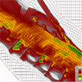
Morphological Assessment of Rivers| Haors and Other features of BWDB through Remotely Sensed Data and Morphological Models.
Review and Provide Decision Supports for the improvement of Mathematical Models including Hydro-dynamic | Hydrological Models from consultants.
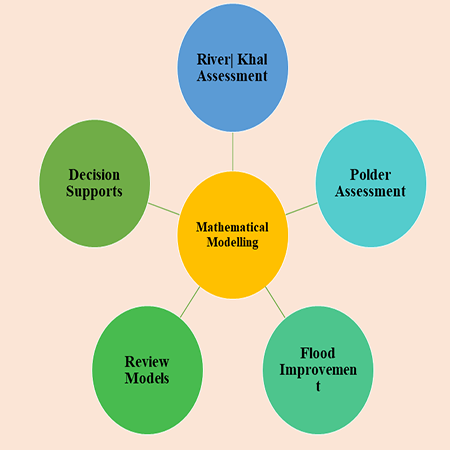
Mathematical Modelling Services
Quality improvement and store of various mathematical models developed by the consulting firm under various feasibility study projects of BWDB and update them accordingly to changing conditions at the field level.